这是休斯顿/哈里斯县各种与食品获取有关的服务的互动地图。数据在2016 - 2017年收集了Hurricane Harvey。
A food desert is a low-income census tract where either a substantial number or share of residents has low access to a supermarket or large grocery store. "Low income" tracts are defined as those where at least 20 percent of the people have income at or below the federal poverty levels for family size, or where median family income for the tract is at or below 80 percent of the surrounding area's median family income. Tracts qualify as "low access" tracts if at least 500 persons or 33 percent of their population live more than a mile from a supermarket or large grocery store (for rural census tracts, the distance is more than 10 miles).
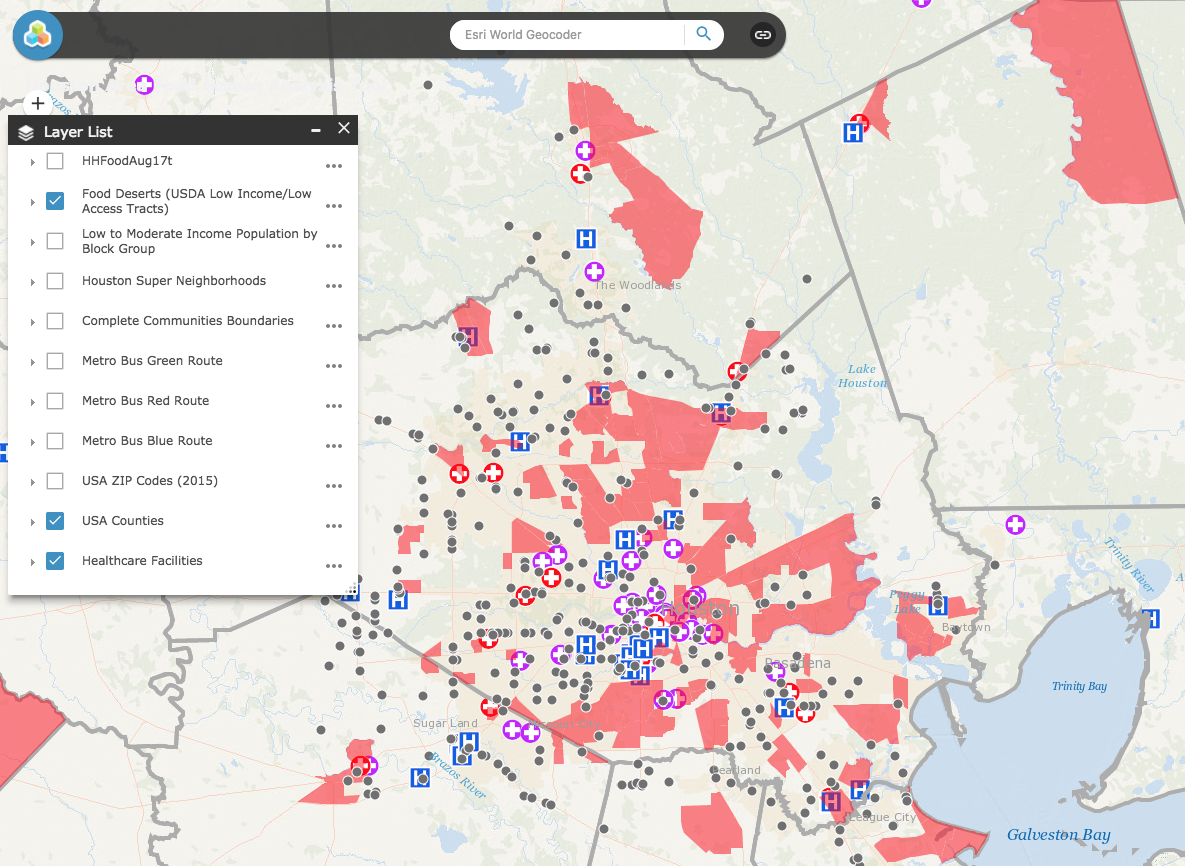
- Step 1 – Click on the link below. The red areas correspond to the food desert areas in Harris County and surrounding regions.
- Step 2 – Click on the green Layers List icon which identifies all the layers incorporated in the map for Harris County.
- Step 3 - Click on the various layers (e.g. Grocery stores, retailers, food pantries etc) to visualize the data. Clicking on the data points on the map and/or zooming in can identify the location at the address level.
- 步骤4 - 根据需要单击多层以可视化分层数据。每个数据点的描述,定义和来源可在描述和定义下找到。
休斯顿地区食品获取地图工具
The Food Insecurity Mapping effort is the result of a cross-sector collaborative supported and funded by theClinton Foundation’s Health Matters InitiativeandGE Healthymagination,由德克萨斯大学健康cience Center at Houston School of Public Health. The platform provides an active lens into current resources as well as opportunity areas. The intent is for the platform to be used by numerous stakeholders, government representatives and residents.
